Check out the new interactive map feature on the Winnipesaukee Gateway website.
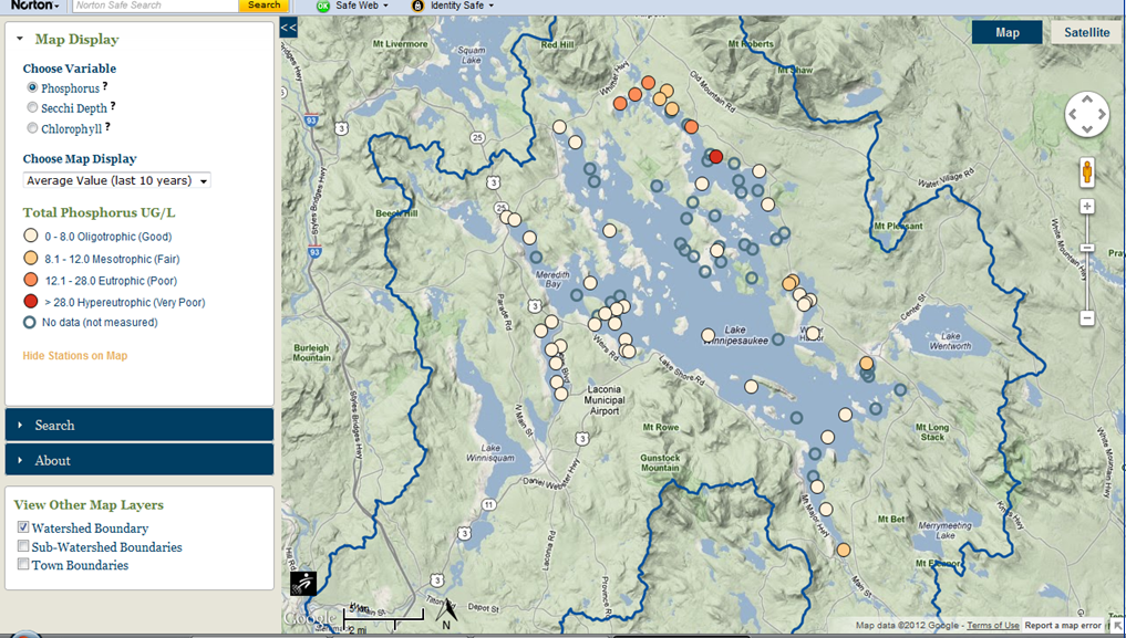
With funding obtained from the National Oceanographic & Atmospheric Administration and the Pardoe Foundation, the Lake Winnipesaukee Watershed Association and the Lakes Region Planning Commission contracted with Applied Geographics, Inc. and GreenInfo Network to bring the available data housed in NH DES’ EMD to life in a visual format. Our goal was to convey the water quality data for the lake in a snapshot. The map, which can be found on the Winnipesaukee Gateway website (http://winnipesaukeegateway.org/), offers the user the ability to access a summary of the water quality data at sampling stations for three parameters; phosphorus, chlorophyll-a, and secchi disk depth for the entire lake.
This is a fantastic piece of work! Quick, visual, data-based and timely. Great clean, simple graphics, contrast of pristine and over-developed on the home page slides, with compelling messaging throughout.
Newfound wants one of these web sites, too!
Great job, Team Winni!