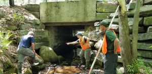
Each summer, trained data collectors conduct field assessments across the state using one consistent protocol, the “New Hampshire Stream Crossing Initiative Field Manual for the Statewide Asset Data Exchange System (SADES)” . This field manual combines the data needs of each representative agency of the Stream Crossing Initiative and results in an efficient, streamlined approach to data collection. By collecting data on multiple facets of the crossing at once, a single survey results in the ability to score a crossing for 1) Geomorphic Compatibility, 2) Aquatic Organisms Passage, and 3) Hydraulic Vulnerability, 4) Asset Condition. These scores can be used together to target culvert replacements.

Electronic data Collection and the Cloud-Based “Statewide Asset Data Exchange System”
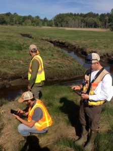
Field data is collected using tablets and uploaded to a cloud-based geospatial system called ArcGIS Online (AGOL). The data is then stored in a shared geodatabase, which is part of The Statewide Asset Data Exchange System (SADES) that is hosted and managed by the University of New Hampshire Technology Transfer Center (T2). The SADES database provides a cloud-based inventory of transportation assets for consistent data collection and sharing. SADES establishes a unique approach to statewide asset management by using modern technology to streamline data collection and management. The Technology Transfer Center has made asset management software packages available for years, however it wasn’t until recent changes in technology aligned with software advances to make the system available and easy to use for the Stream Crossing Initiative. Data collectors communicate their findings and work collaboratively through the SADES program to document and verify stream crossings locations throughout the state that are most problematic

For information on UNH T2 and SADES, please contact Chris Dowd, SADES manager at chris@nhsades.com or 603-862-5489.
The scores from the stream crossing assessments are publicly available on the NHDES Aquatic Restoration Mapper.
